Timothy Pont c 1590
| < Laurence Nowell – 1560 | Δ Maps | Timothy Pont’s portrayal of towns > |
Timothy Pont was born around 1564, possibly at Shirehill in Fife. He was the second son of the Reverend Robert Pont (1524-1606), an eminent and influential Scottish clergyman, practising lawyer, and writer.
In 1574, Robert bestowed a modest annual grant of church funds on Timothy, which presumably gave his son a certain degree of independence.
After studying at St Andrews University from 1580 to 1583, he appears to have spent the late 1580s and the 1590s travelling throughout Scotland, mapping the country.
Pont’s maps are important because they are the first detailed maps of Scotland. They were never published in his lifetime, but eventually were cleaned up by Robert Gordon and his son James Gordon before being sent to Joan Blaeu a renowned map-makers of Amsterdam. Blaeu used the manuscript Pont maps as the major primary source of information for the maps of Scotland in volume 5 of his world atlas published in Amsterdam, 1654.
With the appearance of Blaeu’s atlas, Scotland became one of the best mapped countries in the world
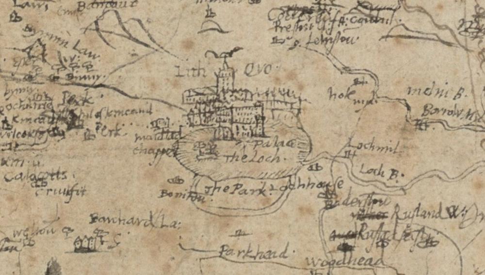
Pont’s original manuscripts are very detailed, for example here is an extract showing the town of Linlithgow
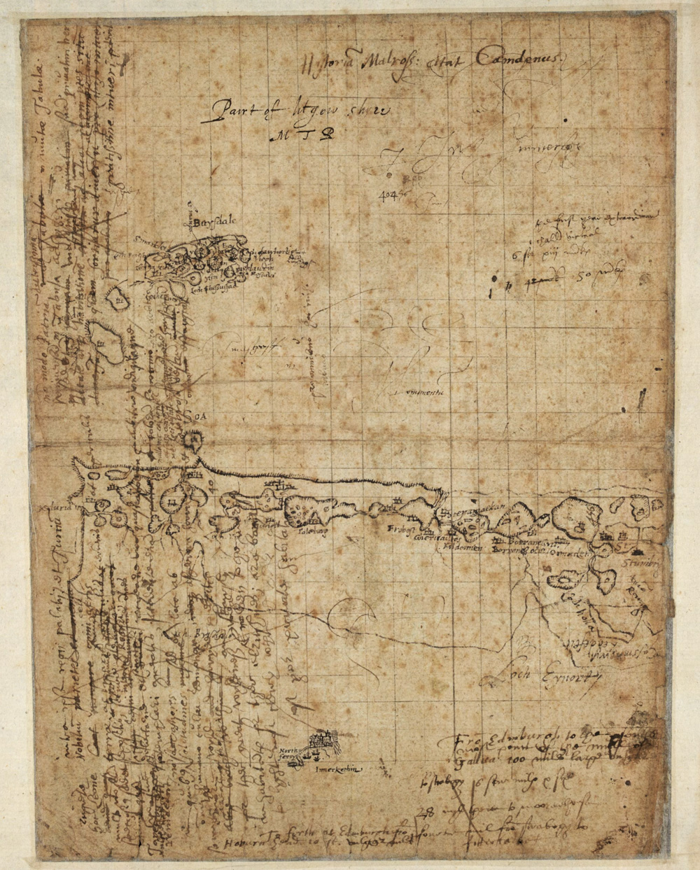
But they are also very hard to interpret. For example this map covers the island of South Uist, but also includes a detailed sketch of Inverkeithing!
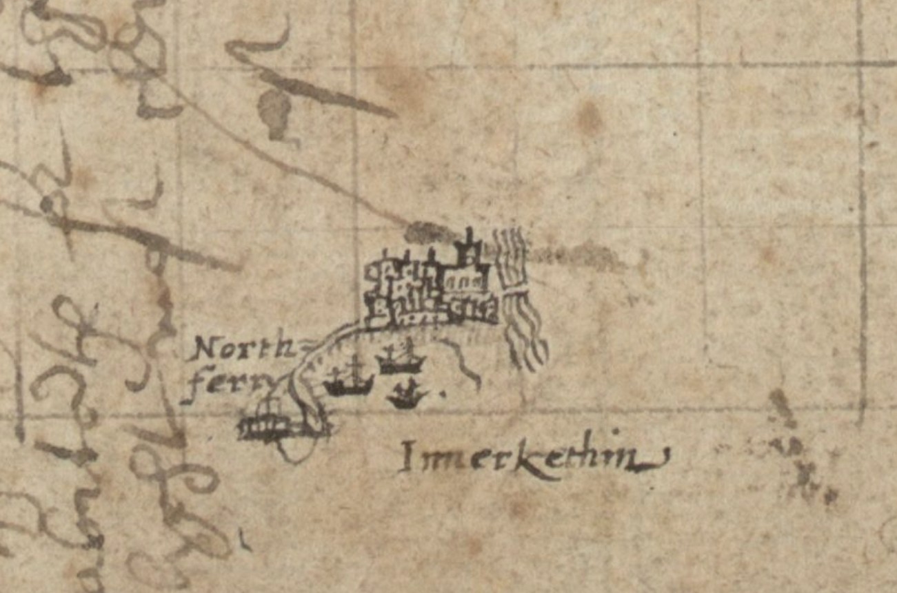
There is no map of south Fife (several manuscripts were lost after Pont’s death), but the sketch of Inverkeithing shows ships riding in Inverkeithing Bay and North Ferrie
Pat Dennison published an essay on Timothy Pont’s portrayal of towns explaining how much detail can be gleaned from these original manuscripts.
There is much more information about Timothy Pont and his maps on the National Library of Scotland website.
| < Laurence Nowell – 1560 | Δ Maps | Timothy Pont’s portrayal of towns > |