William Roy – 1747
| < John Adair – 1703 | Δ Maps | Jacques-Nicolas Bellin 1757 > |
Despite these new maps from Adair and Moll, the army in 1746 found itself ‘greatly embarrassed for the want of a proper survey of the country’, and it was this lack that led to William Roy‘s Military Survey of Scotland (1747-55), which resulted in the most important detailed map of mainland Scotland in the 18th century.
Starting in 1747, it took eight years to complete what was known as the Great Map at a scale of 1:36 000 (1.75 inches to a mile). Roads, hills, rivers, types of land cover and settlements were recorded. William Roy described it as rather a ‘magnificent military sketch than a very accurate map of the country’.
Roy’s surveying parties of about eight relied on simple surveying compasses to measure the angles, and chains up to 50 feet long to measure distance between important features. Much of the rest was sketched in by eye. Nevertheless, the map was a powerful tool as part of a broader strategy to open up access to the Highlands.
Here is our familiar stretch of the Firth of Forth as depicted by Roy.
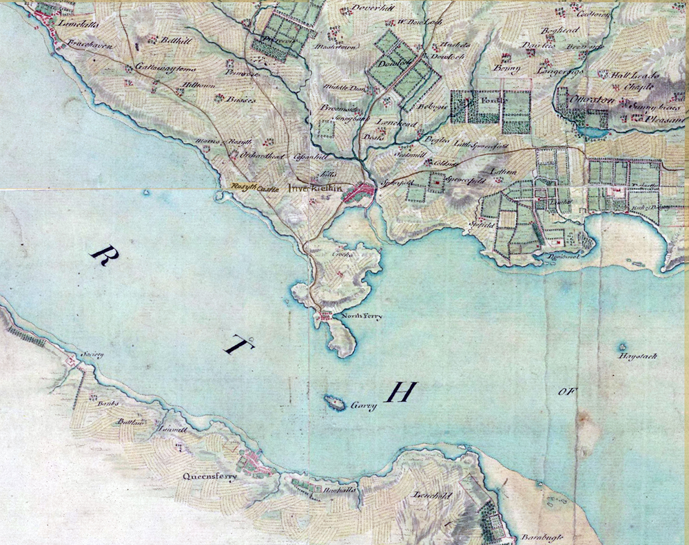
Roy’s map of Scotland was kept securely in the King’s Royal Library in London because of its strategic and military value. It was not until the early 19th century that it was first properly seen and used by other mapmakers.
The National Library of Scotland website has copies of Roy’s Military Survey of Scotland, 1747-1755, and William Roy’s – Military Antiquities of the Romans in North Britain, 1793.
| < John Adair – 1703 | Δ Maps | Jacques-Nicolas Bellin 1757 > |