Jacques-Nicolas Bellin 1757
| < William Roy – 1747 | Δ Maps | John Ainslie – 1785 > |
Maps were also important to foreign miliary forces. Jacques-Nicolas Bellin was the official hydrographer to King Louis XV, as entrusted with the production of charts and atlases that served not merely as navigational aids but as tools of imperial governance and strategic warfare.
During the Seven Years’ War (1756–1763), Bellin’s maps were critical to French naval operations across multiple theatres of conflict, including North America, the Caribbean, and the Indian Ocean.
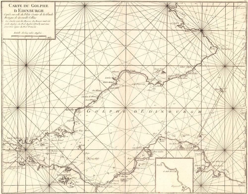
Here is his “Carte du Golphe d’Edinburgh.” published in 1757
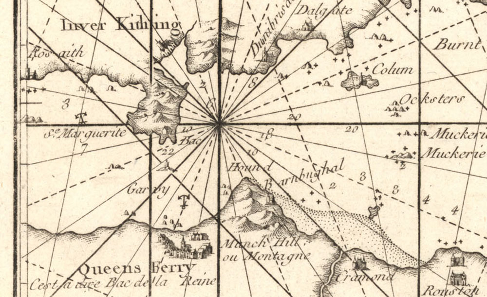
Queensferry carries the note “C’est à dire Bac de la Reine” “That is to say the Queen’s Bac”
A bac is a flat-bottomed boat typical of Normandy. They are still used to allow locals and passing visitors to cross the River Seine at several key points.
The National Library of Scotland website has copies of eight of Bellin’s charts.
| < William Roy – 1747 | Δ Maps | John Ainslie – 1785 > |