1900 – The move to North Queensferry
| < 1898 – The move to South Queensferry | Δ Index | 1901 – Boys Brigade > |
1900 first camp at North Queensferry.
Although the men were camped at North Queensferry, much of the activity was on the opposite shore of the Forth.
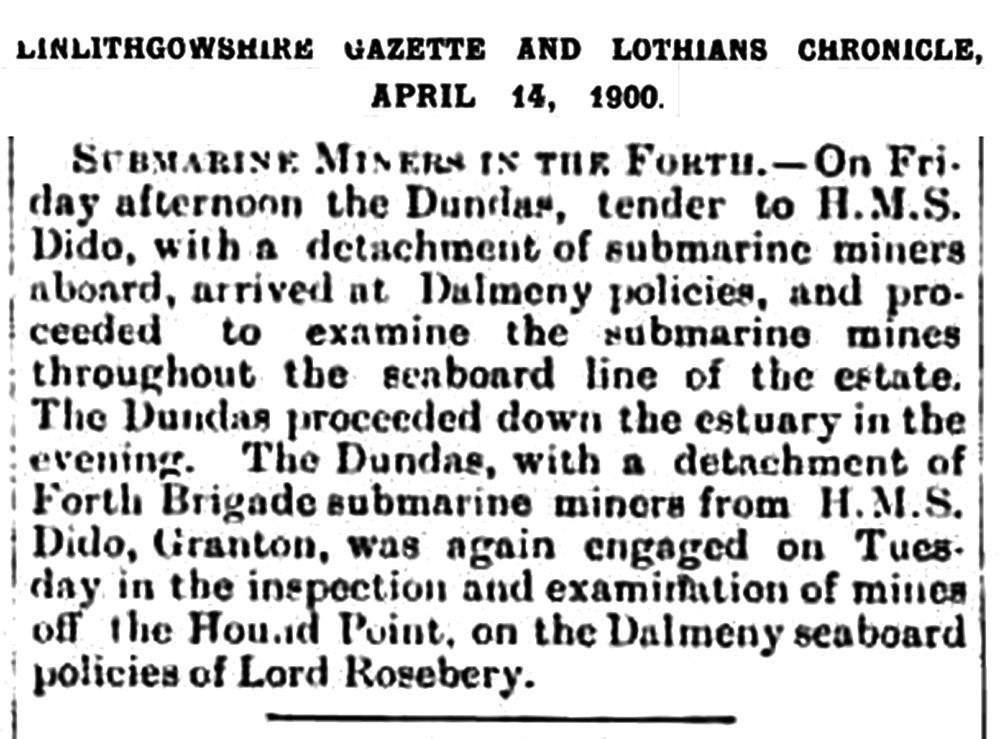
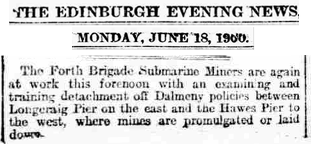
Henry Cadell photographed the camp.
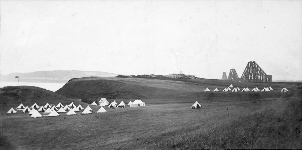
Forth Division R.E. Submarine Miners Camp North Queensferry 1900
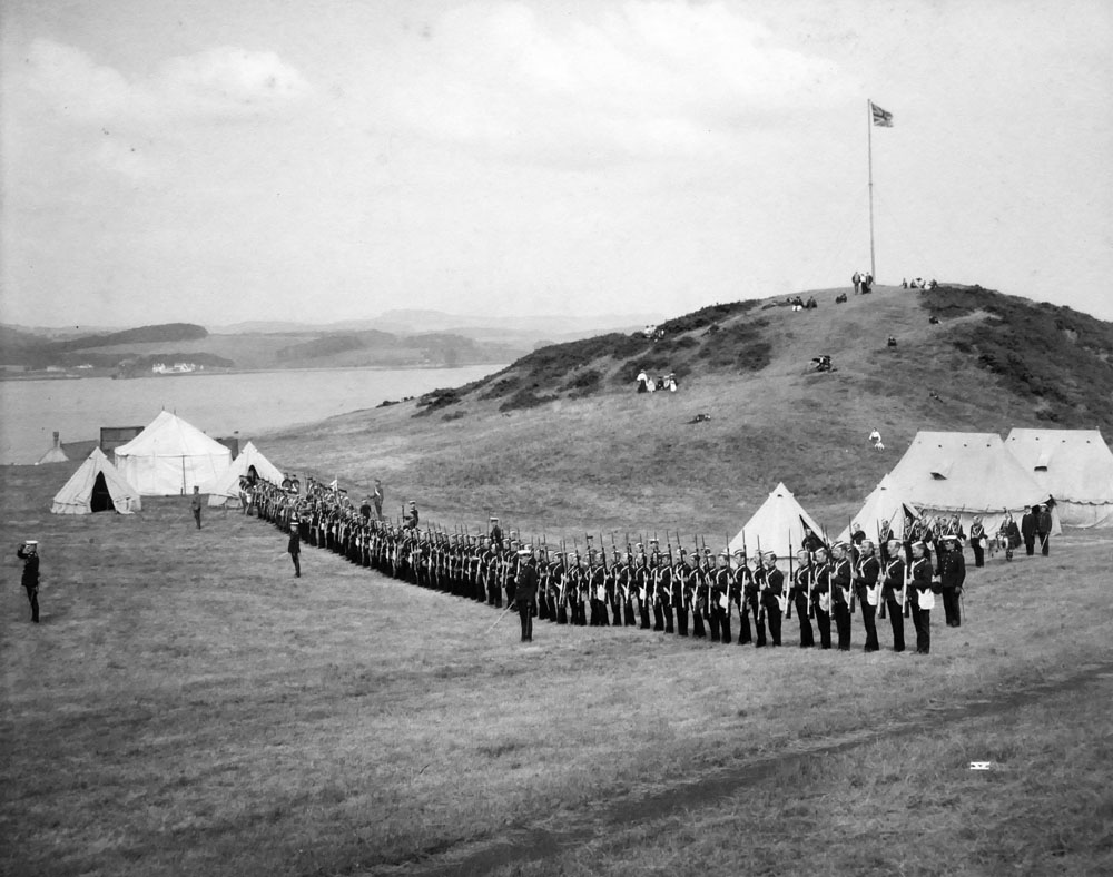
Forth Division R.E. Submarine Miners Camp North Queensferry 1900
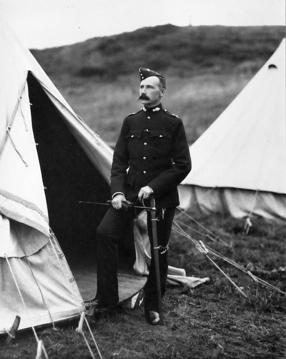
Forth Division R.E. Submarine Miners Camp North Queensferry 1900
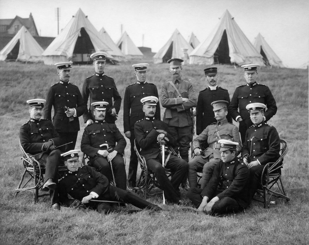
Forth Division R.E. Submarine Miners Camp North Queensferry 1900
While here, Henry Cadell conducted test drillings at Port Laing, to establish the suitability of the site for a new permanent Submarine Mining Station.
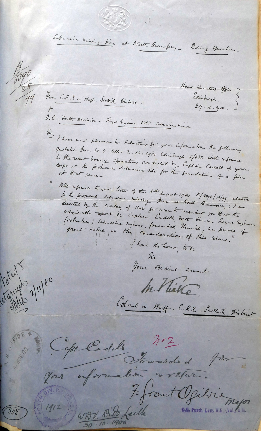
Submarine Mining at North Queensferry – Boring Operations
Head Quarter Office
Edinburgh
29 10 1900
From CRE on staff Scottish District
to
O.C. Forth Division Royal Engineers Vol. Submarine Miners
Sir,
I have much pleasure in submitting for your information the following
quotation from W.O. letter 2. 10. 1900 Edinburgh 5/623 with reference
to the recent boring operations conducted by Captain Cadell of your
corps at the proposed submarine site for the foundation of a pier
at that place.
“With reference to your letter of the 8th August 1900 B/8390/16/99,
relative to the proposed Submarine Mining Pier at North Queensferry,
I am directed by the Secretary of State for War to acquaint you that the
admirable report by Captain Cadell Forth Division Royal Engineers
(Volunteer) Submarine Miners, forwarded therewith, has proved of
great value in the consideration of the scheme.”
I have the honour to be,
Sir
Your Obedient Servant
M Kirke
Colonel in Chief CRE Scottish District
Capt Cadell
Forwarded for your information and reflection
F Grant Ogilvie – Major
Forth defences from Port Laing to Dalmeny
The result of Cadells’ survey was the construction of the “Guv’y Pier” with narrow gauge railway linking the pierhead to the new submarine mining station on the shore at Port Laing.
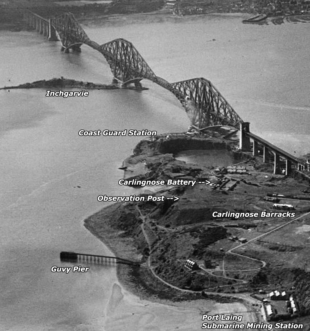
Above Port Laing, Royal Engineers constructed Carlingnose Barracks and Carlingnose Battery – fitted out with two 6 inch guns, which could swivel through 360 degrees, to protect the site from any land-borne intrusion, as well as covering the Firth of Forth. New electric searchlights were installed at the existing Coast Guard Battery
Gun batteries and searchlight stations were built on Inchgarvie and at Dalmeny, with a further battery at Hound Point.
These guns and lights could all focus on any enemy ships attempting to sail through the friendly channel, where they could also be attacked by observation mines.
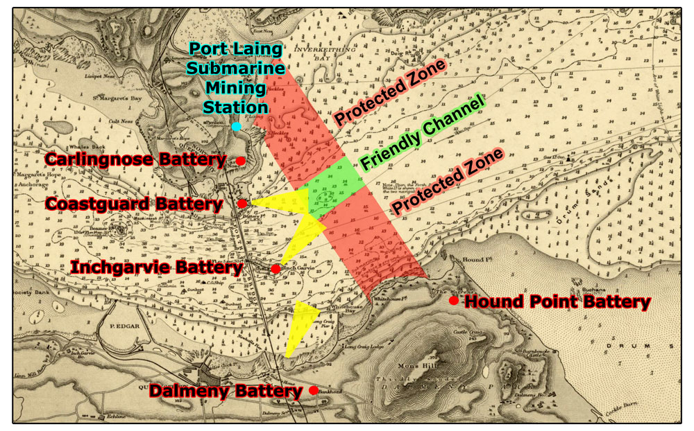
This diagram is my estimate of the likely layout of the minefield.
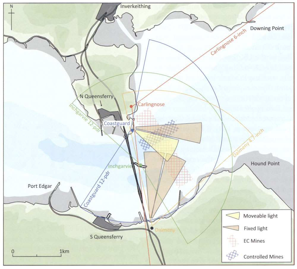
This second diagram is from “The Fortification of the Firth of Forth 1880 – 1977” by Gordon Barclay and Ron Morris- p31. It is redrawn from WO 75/5179.
I was rather pleased with the accuracy of my estimate!
| < 1898 – The move to South Queensferry | Δ Index | 1901 – Boys Brigade > |