Ordnance Survey Maps of Great Britain
Ordnance Survey Maps of Great Britain
The first published O.S. Map
OS Name Books
North Queensferry Place Names
The Ordnance Survey – Britain’s mapping agency – has its roots in military strategy: mapping the Scottish Highlands following the Jacobite rebellion in 1745.
It was an innovative young engineer called William Roy who was tasked with the initial military survey of Scotland.
Starting in 1747, it took eight years to complete what was known as the Great Map at a scale of 1:36 000 (1.75 inches to a mile). Roads, hills, rivers, types of land cover and settlements were recorded. William Roy described it as rather a ‘magnificent military sketch than a very accurate map of the country’.
Roy’s surveying parties of about eight relied on simple surveying compasses to measure the angles, and chains up to 50 feet long to measure distance between important features. Much of the rest was sketched in by eye. Nevertheless, the map was a powerful tool as part of a broader strategy to open up access to the Highlands.
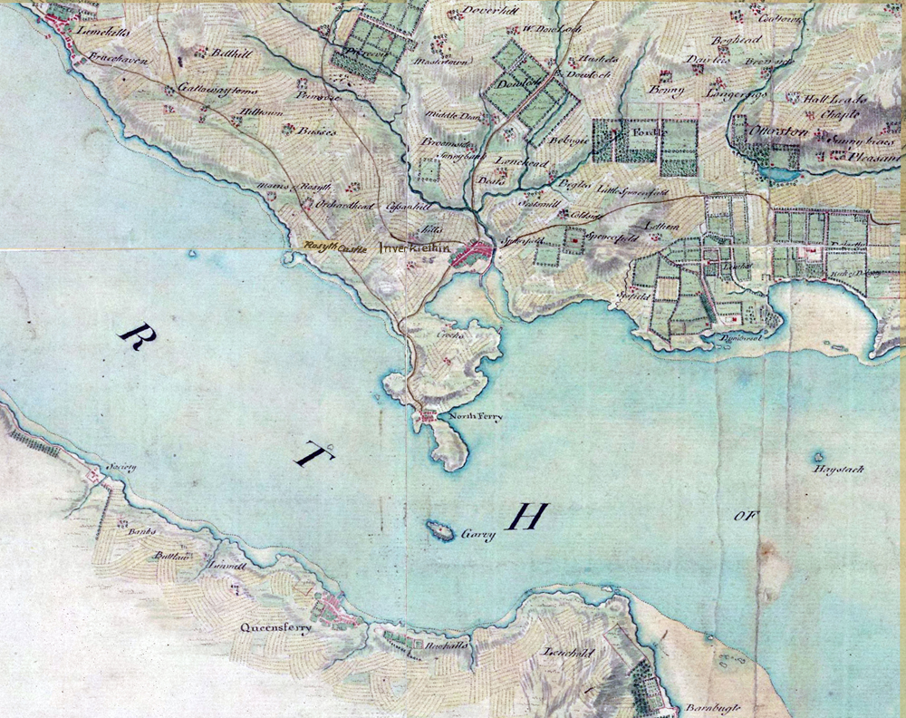
Here is our familiar stretch of the Firth of Forth as depicted by Roy.
On the other side of the English Channel, the French Revolution rumbled on from 1787 to 1799, raising fears that bloodshed might sweep across to our shores.
So the government ordered its defence ministry of the time – the Board of Ordnance – to begin a survey of England’s vulnerable southern coasts, with sufficient detail and accuracy to plan military campaigns and troop movements.
Roy was commissioned by the Royal Society to geodetically connect the Royal Observatories of Greenwich and Paris to solve a dispute over their relative positions. To do this he needed a sophisticated theodolite created by Jesse Ramsden, the leading instrument maker of the day – the Great Theodolite, three years in the making, measuring three feet across.
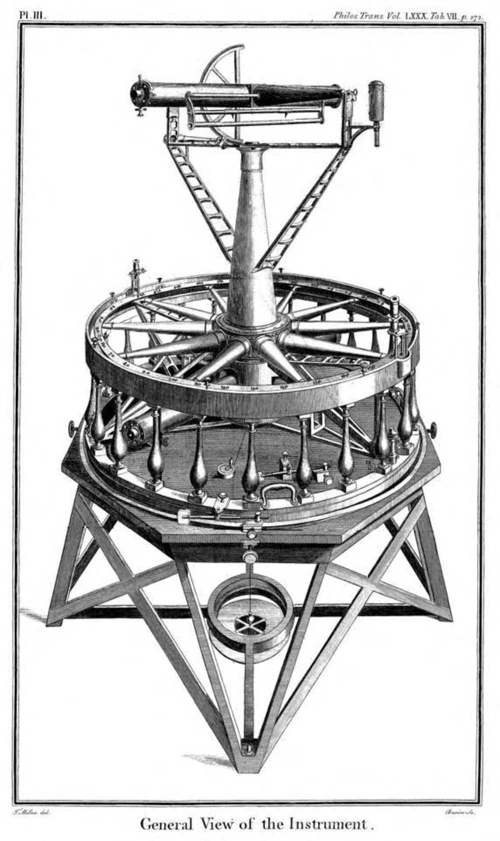 Ramsden’s Great Theodolite of 1787
To begin the London/Paris triangulation, it was necessary to measure a baseline that Roy established on the flattest suitable ground on Hounslow Heath (a line that now crosses Heathrow airport).
Using the Ramsden theodolite and trigonometry, a network of accurately measured triangles was extended to France and then back to a verification baseline in Kent.
In recognition of his achievement, the Board of Ordnance bought a second new (and improved) Ramsden theodolite. The date was 21 June 1791 – officially recognised as the birth of Ordnance Survey.
Starting from the Hounslow Heath baseline, the surveyors used theodolites and trigonometry to create an accurate network of triangles based on prominent landmarks.
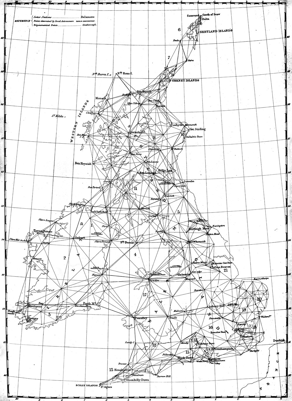 The principal triangulation of Britain – 1860
These triangles formed the mapping framework, then the details were added by hand. The early maps featured elaborate hill shading and attention to communication routes, highlighting the emphasis given to military use.