Today – has anything survived?
| < 1943 – Gimmers | Δ Index | Bobbie Banks – reminiscing on the old golf course > |
During the years from the time the course closed in 1940, the quarry has continued to expand, and the road from North Queensferry to Jamestown has changed location.

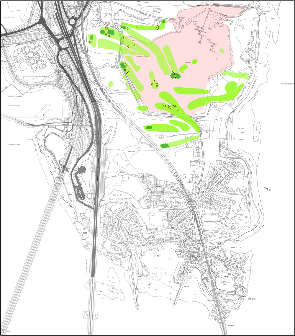
Map of the course derived from aerial photographs overlaid on a 2016 OS map, with the quarry highlighted.

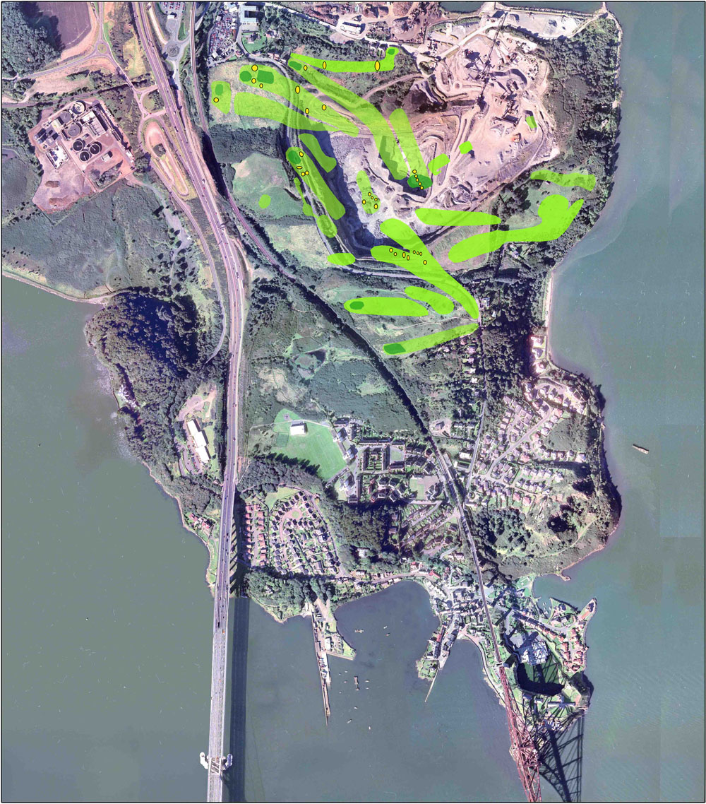
Map of the course derived from aerial photographs overlaid on a “satellite” view from 2010.
Intriguingly, despite all these changes, the locations of two of the holes from 1921 have not been consumed.
One is the dog-leg hole which ran parallel to Crookness Road.
The other is more accessible – it runs along the top edge of the field, just to the south of the reservoir.
So next time you are passing that way, or spot some of the sheep from the travelling flock, give a thought to the many “gimmes” and gimmers that once roamed these fields.
Meantime, here is an audio recording of Bobbie Banks – reminiscing on the old golf course.
| < 1943 – Gimmers | Δ Index | Bobbie Banks – reminiscing on the old golf course > |