John Hardyng – 1457
| < Matthew Paris – 1250 | Δ Maps | Laurence Nowell – 1560 > |
The earliest surviving detailed map of Scotland was compiled by John Hardyng, who was born in 1377 or 1378, probably in Northumberland, and lived most of his life during the Hundred Years’ War between England and France. He joined the household of Henry Percy (‘Hotspur’) when he was 12 years old, and fought for the Percys in Anglo-Scottish border battles. He also served in France during the reign of Henry V, who sent him on a spying mission to Scotland in 1418.
In 1457, Hardyng presented the first version of his Chronicle to King Henry VI of England, as part of his failed attempt to instigate an invasion of Scotland. The Chronicle is accompanied by this colourful map, spread across two pages, which depicts a very rectangular Scotland with west at the top. Hardyng doubtless drew on his earlier years of reconnaissance in Scotland in compiling his map. It includes much more topographical information and many more towns right across Scotland than in earlier surviving maps.
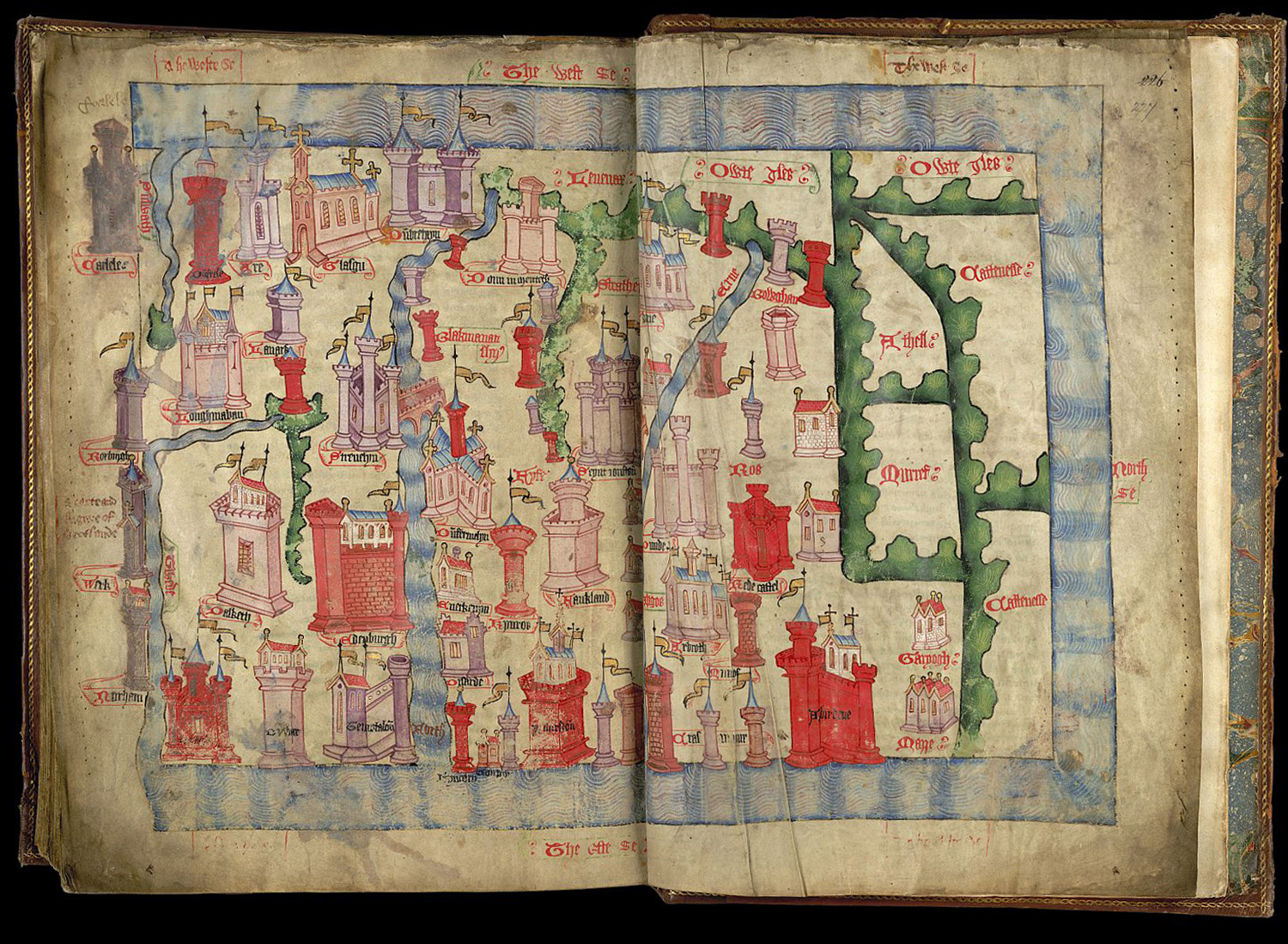
The castles and walls of the towns are remarkably varied, while at Glasgow and Dunfermline the churches are drawn instead. The rivers are very clearly marked, with the River Forth, bridged at Stirling, running from top to bottom, and almost cutting the kingdom in two.
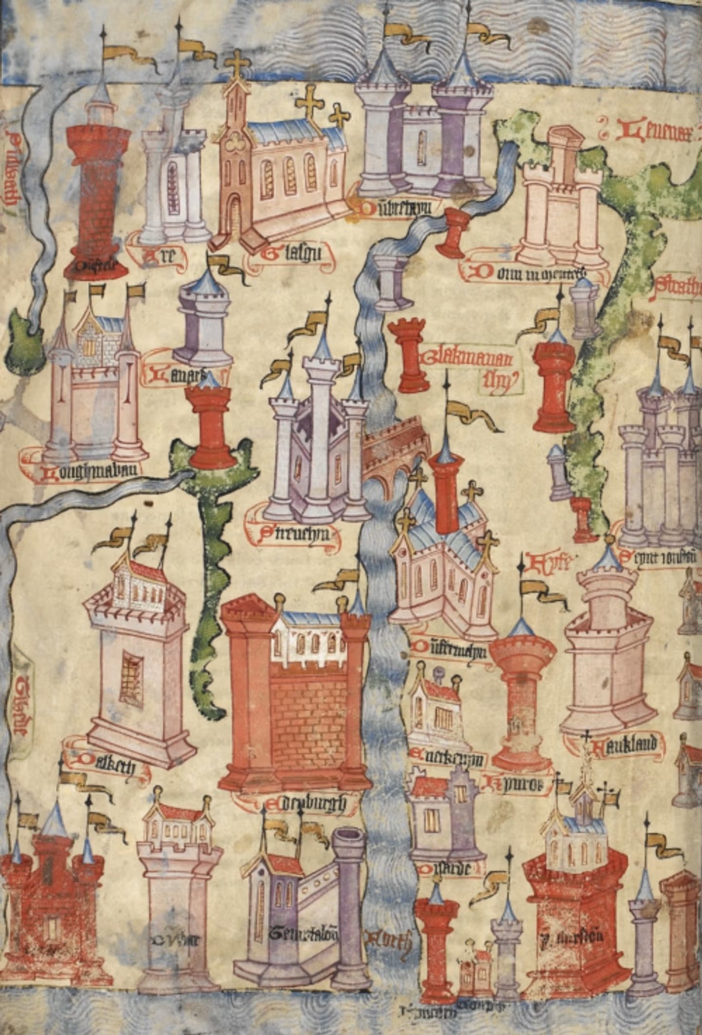
Dunfermline and Inverkeithing are marked on the north (right) bank of the Forth.
You can read more about this map on this blog from the British Library
| < Matthew Paris – 1250 | Δ Maps | Laurence Nowell – 1560 > |