Matthew Paris – 1250
| < Ptolemy 2nd Century AD | Δ Maps | John Hardyng – 1457 > |
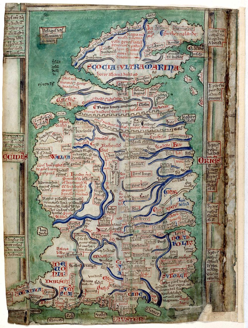
A few centuries before Ptolemy’s map was rediscovered, Matthew Paris (c. 1200–1259), a Benedictine monk of St Albans Abbey, produced a map of Britain in the 1250s.
It survives in four manuscripts and presents the island with north at the top, an orientation that makes it feel strikingly direct compared with many medieval world maps. Rather than aiming for scale, Paris lays Britain out as a long, narrow shape that is meant to be read—a visual guide to places and landmarks.
What stands out immediately is the density of information. Paris provides over 250 place-names, packing the map with towns, regions, religious houses, and coastal points, while using rivers and key features to organise the geography. He even includes two Roman frontiers—Hadrian’s Wall and the Antonine Wall.
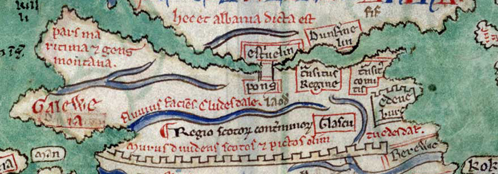
The texts north of the Forth read:
hec et albania dicta eft – This land was also called Albania
pars maritima gens montana – A maritime region and a mountainous people (Ayrshire)
Dunfermline and Fife
eft’uelin pons – Stirling bridge, crosses the Forth
Opposite Dunfermline is transitus regine – Queen’s Passage or Crossing
You can explore the full map on this interactive version
| < Ptolemy 2nd Century AD | Δ Maps | John Hardyng – 1457 > |