Ptolemy 2nd Century AD
| < Maps | Δ Maps | Matthew Paris – 1250 > |
Claudius Ptolemaeus (Ptolemy) was a Roman citizen of Macedonian descent, who lived and worked in Alexandria, Egypt.
He was a celebrated geographer and astrologer who lived between the reigns of Hadrian and Antonine in the second century A.D. He wrote all his scientific works in Greek but his work was lost for over a thousand years to Western scholarship.
At the end of the thirteenth century, the Byzantine scholar Maximos Planudes located a copy of Ptolemy’s Geographia, that listed places using latitude and longitude and explained how maps could be constructed from those coordinates. (The original document probably included maps drawn by Ptolemy, but only the tables of data have survived.)
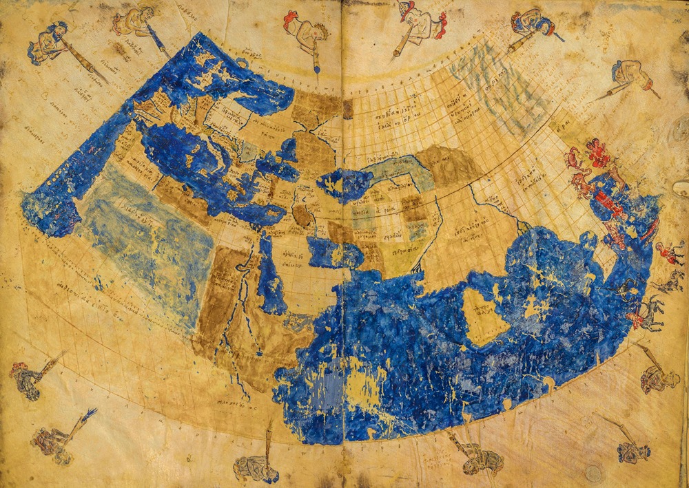
Planudes and his team appear to have redrawn the maps from the numerical data, producing the earliest surviving Greek manuscript tradition with a full set of Ptolemaic maps.
The data set for the British Isles includes the location of many Roman towns, rivers and estuaries, and the names of the local tribes.
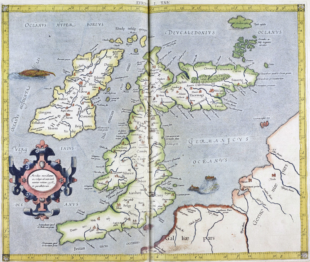
When the data is used to construct a map, there is an obvious distortion in which Scotland turns sharply eastward compared with the rest of Britain.
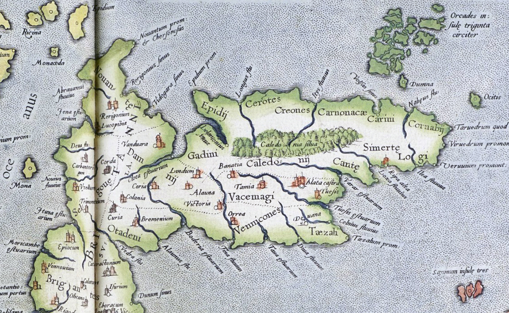
Trimontium (Melrose) is clearly marked, as are Clota estarium (the Clyde Estuary), Boderia estarium (The Forth Estuary), Tina Fluvium (Eden River), and Colanica (Selkirk).
Further south are Moricambe estuarium (Morecambe Bay), Bremenium (Rochester) and Eboracum (York)
Why the distortion?
A possible explanation is that the data for the country south of Hadrian’s Wall was derived from accurate surveys carried out by the occupying Romans, while land to the north was surveyed from the sea, possibly by Pytheas.
Pytheas of Massalia was a Greek geographer, explorer and astronomer from the Greek colony of Massalia (modern-day Marseille, France). He made a voyage of exploration to Northern Europe in about 325 BC, but his account of it, known widely in antiquity, has not survived and is now known only through the writings of others.
On this voyage, he circumnavigated and visited a considerable part of the British Isles. He most likely travelled from Marseille to Cadiz then Brest and up to Aalborg before sailing round Scotland and probably up to Iceland.
Ptolemy may have used Pytheas’s data set.
Bill Thayer in his LacusCurtius website, discusses the issue.
While modern data sets of latitude and longitude use the Greenwich Meridian as 0 degrees East/West and the Equator as 0 degrees North/South, Ptolemy and Pytheas each used their own reference points.
Simon M’s Saxon History website includes his own hypothesis which postulates that Pytheas may have used Brest in France and Aalborg in Denmark as his reference points. Ptolemy (working 400 years later) may way have assumed that Pytheas’s reference points were Wexford in Eire and Bremen in Germany. Simon has reverse engineered the latitude and longitude data to produce a map which is much closer to “reality”.
| < Maps | Δ Maps | Matthew Paris – 1250 > |