Ordnance Survey Name Books
| < The first published O.S. Map – 1801 | Δ Maps | North Queensferry Place Names 1856 > |
Place Names were gathered from existing maps and signposts and “prominent local citizens” were consulted. Variations of all proper names such as rivers and hills, as well as towns, were recorded in a series of books and from this selection the most authoritative was chosen for publication.
Images and transcripts of the original Name Books covering Scotland are available on the Scotlands People website.
There are 135 Name Books books covering the Counties of Fife and Kinross.
North Queensferry
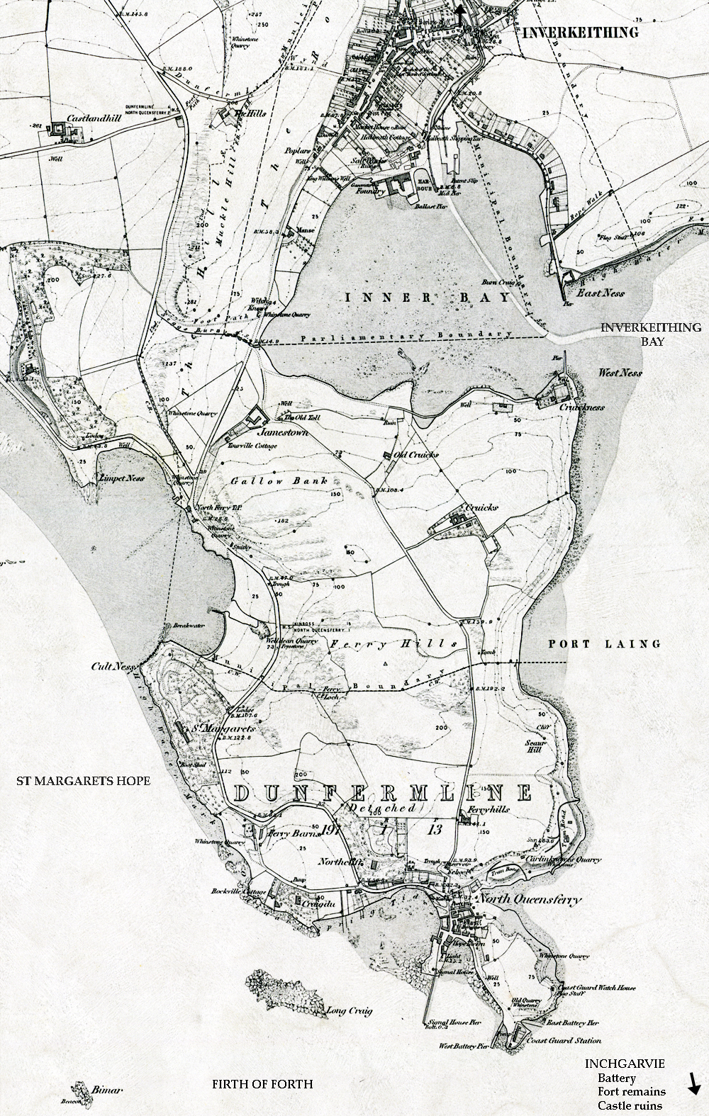
The North Queensferry Peninsula is covered by Volume 76 which includes part of the Parish of Inverkeithing (north of a line from Cult Ness to Port Laing), and a detached part of the Parish of Dunfermline (south of this line.)
The information was gathered from 1853 to 1855 and used to annotate this 1856 map
| < The first published O.S. Map – 1801 | Δ Maps | North Queensferry Place Names 1856 > |