The first published O.S. Map – 1801
| < Origins of the Ordnance Survey – 1791 | Δ Maps | OS Name Books > |
The first Ordnance Survey map (of Kent) took three years to complete; it was published in 1801.
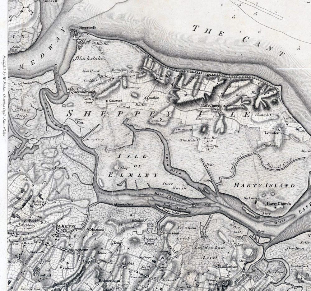
(This extract from the 1801 map of Kent shows part of the Isle of Sheppey, including Leyden and Eastchurch, where one hundred years later in 1901, the Aero Club of Great Britain was formed. In 1910, the club trained the first Naval Aviators who arrived in North Queensferry in 1912 to form the Royal Naval Air Station at Carlingnose.)
A map of Essex followed in 1805 The public could buy the new Ordnance Survey maps from the Board of Ordnance headquarters, or from William Faden, a map seller at Charing Cross. They cost three guineas (£3 3s) per county survey, which was between one and three weeks’ wages for the average person. Part of their appeal was they offered a bird’s eye view of the landscape – until then only the privilege of a very few hot air balloonists.
Within 20 years, about a third of England and Wales had been mapped. It was thought that 50 years would be long enough to map the country, but the entire first series of maps wasn’t published until 1870.
The first OS map of North Queensferry peninsula was published in 1855.
The National Library of Scotland website has a huge collection of O.S. maps.
Ordnance Survey Name Books
As well as carrying out a survey of the land to create the “artwork” for the map, the map-makers also had to determine the name of each geographical feature that appeared on the map. Place names often proved difficult as locals could argue over what name was actually correct.
Eventually an Ordnance Survey Name Book system was put in place.
| < Origins of the Ordnance Survey – 1791 | Δ Maps | OS Name Books > |