1872 Dunfermline and Queensferry Railway
| < The Charlestown Bridge | Δ The Queensferry Passage | Old Railway Station > |
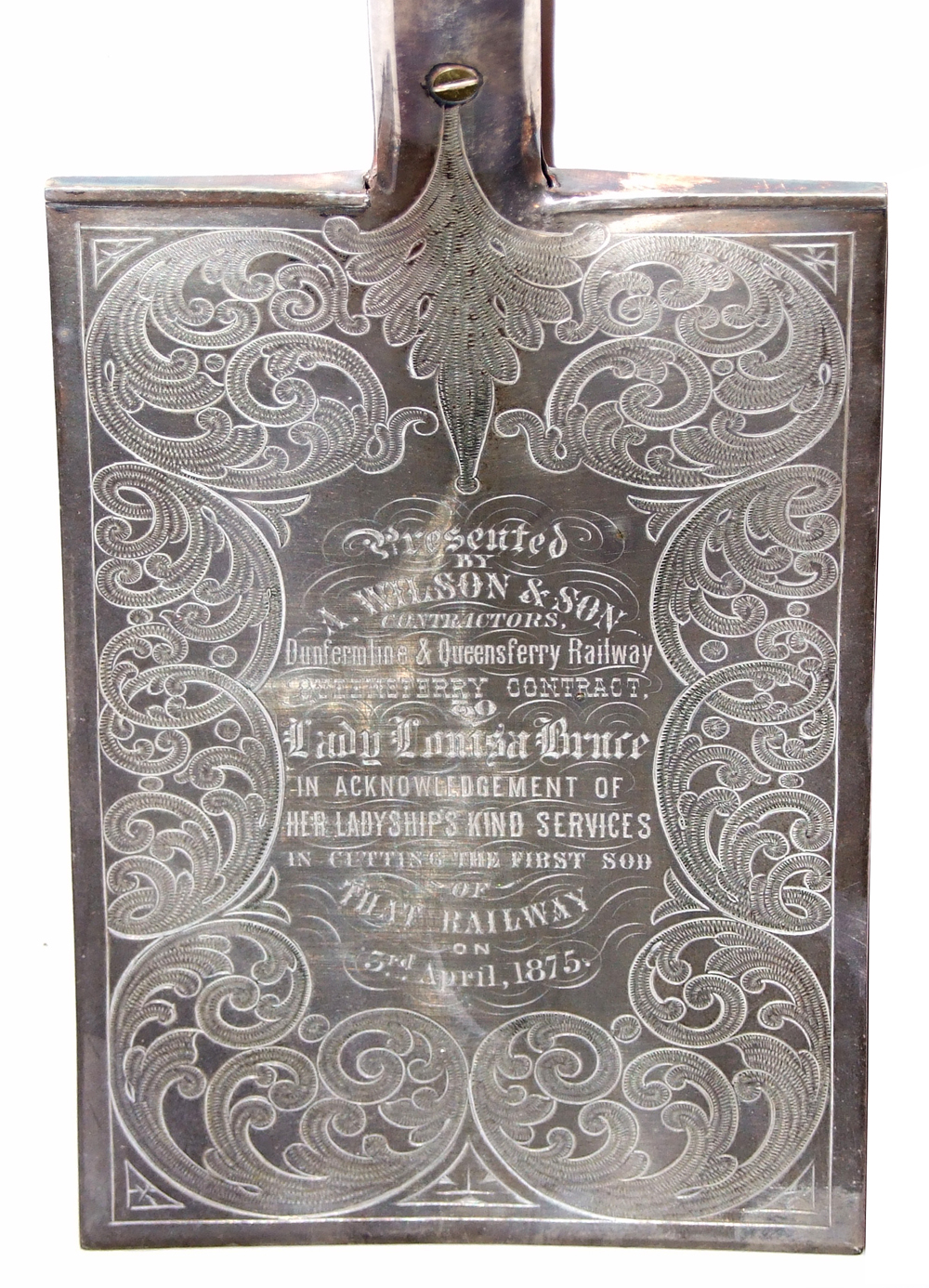 The spade used by Lady Louisa Bruce to cut the first sod of the Dunfermline to North Queensferry Railway. 3rd April 1875. Presented by A. Wilson and Sons – contractors on the Queensferry end of the line,
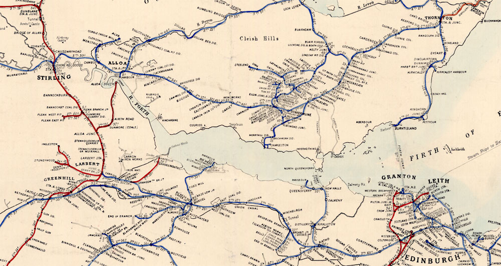
This extract from John Airey’s Railway Map of Scotland, 1875 shows the problem faced by the citizens of Dunfermline attempting to travel to Edinburgh. They could take the long loop via Stirling or go via Thornton to Burntisland to connect with ferry to Granton.
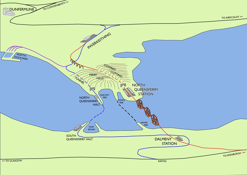
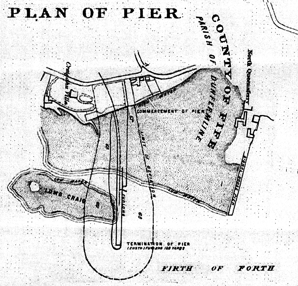
Before the Forth Bridge was built, the Dunfermline and Queensferry railway offered a short term alternative. It ran from Dunfermline to the North Queensferry Railway Pier, and from there by Ferry to Port Edgar and on to the existing line to Edinburgh via Kirkliston and Ratho. (You can walk along the track of the old railway from the Scotmid Car Park in South Queensferry all the way to Kirkliston.)
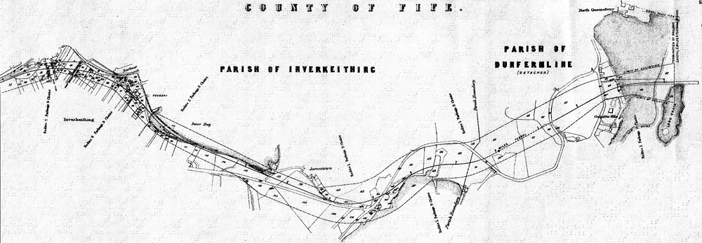

Dunfermline 30th November 1872. There were within the Sheriff Clerks Office there deposited within the foregoing “Plans and Sections of Proposed Dunfermline and Queensferry Railway November 1871 consisting of three sheets and having annexed thereto a Published Map, with Gazette Notice and Book of Reference, in terms of the Standing Order of Parliament, and that between the hours of nine and eleven forenoon, and which were then and there duly sealed up by me – Also were deposited for Public inspection a full double of said Plans & Sections, Map & Gazette & Book of Reference. (Signed) William Blair Sheriff Clerk Depute of Fife
Here is the railway plan on a modern OS map.
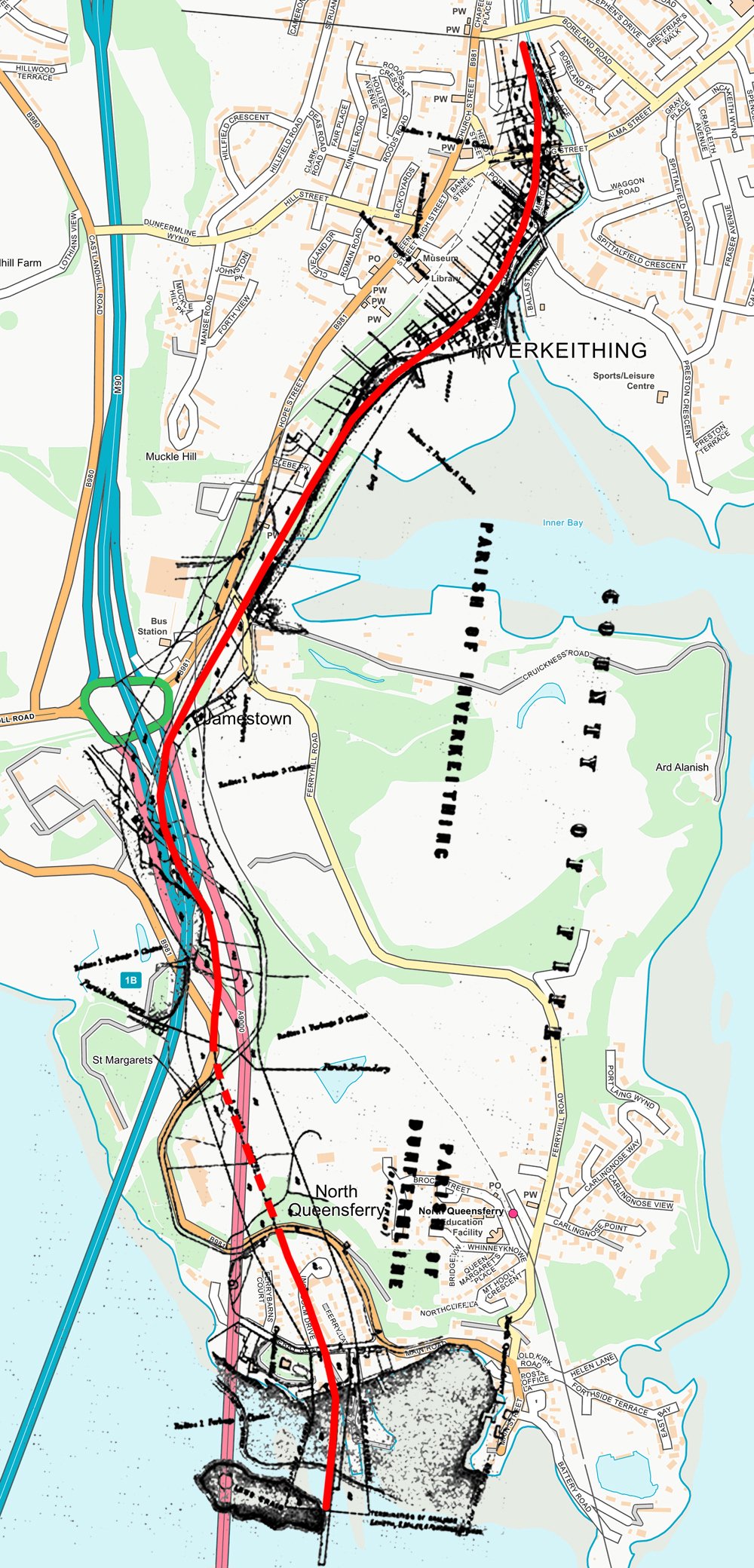
The line ran from Inverkeithing station along the edge of the bay, past Jamestown then it tunnelled though the Ferry Hills to emerge in a cutting next to Nivens Farm and run under the bridge on Ferry Road to the Old Railway Station at the the Railway Pier.
| < The Charlestown Bridge | Δ The Queensferry Passage | Old Railway Station > |