Crossing the Forth
| < Build-up to the Battle | Δ Index | The Sea-borne Invasion > |


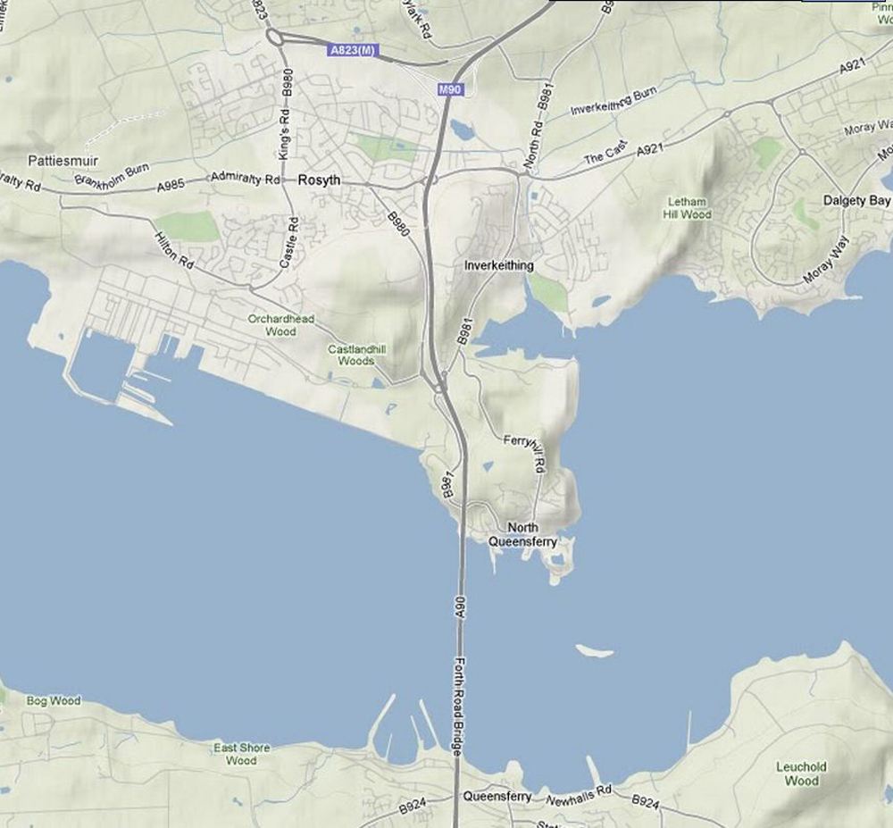
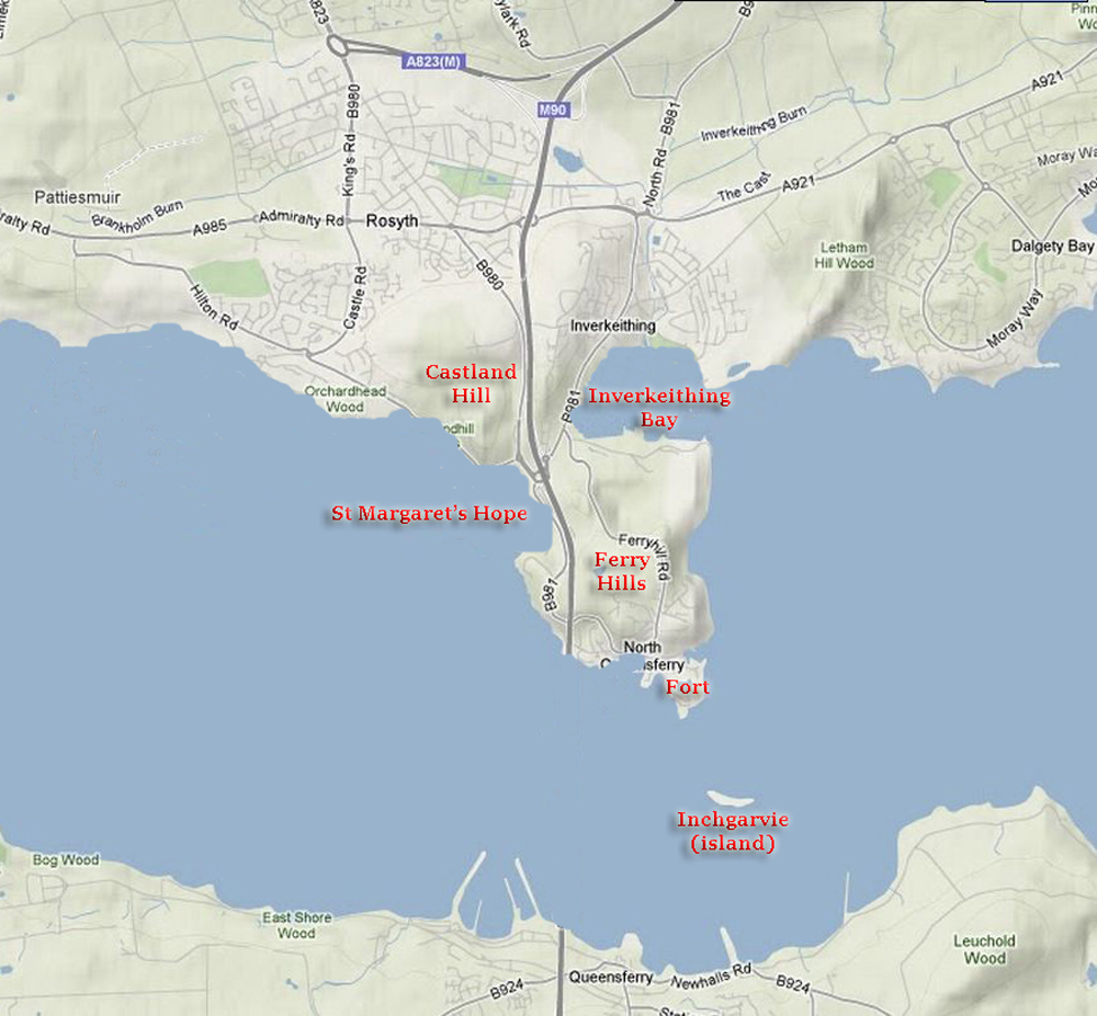
The coastline has changed significantly since the time of the battle, with major land reclamation in the early 20th century between North Queensferry and Rosyth. These maps show the coastline as it is at present (left) and as it was in Cromwell’s day (right.)
The peninsula of North Queensferry was much more isolated, with a narrower neck between Inverkeithing Bay and St Margaret’s Hope. St Margaret’s Hope provided a large safe haven for shipping. Inverkeithing Bay was larger, and Castland Hill swept down to the shores of the river.
The Forth defences included a heavy battery at Burntisland, a battery of 16 cannon on Inchgarvie island plus the defences of North Queensferry itself – 12 cannon on the Ferry Hills, 5 cannon in the Fort, and an armed guardship in the sheltered waters of St Margaret’s Hope.
While these guns were all capable of sinking a ship, they were not very accurate with an effective range of no more than 500 metres.
Deane had been testing these defences for some months. Some of his ships had slipped past Inchgarvie and captured the guardship in the Hope. He found that if he sailed some ships close to the defences, others could slip past in the confusion.
| < Build-up to the Battle | Δ Index | The Sea-borne Invasion > |